Anaptixi is a growing research and engineering Greek company founded in 1994 that specializes in the collection, processing and management of spatial information. Anaptixi’s main lines of work cover digital mapping, topographic surveying and transportation engineering as well as other Geographic Information Systems (GIS), remote sensing and photogrammetry activities. Anaptixi is frequently involved in cadastral projects related to property and land registration for over 2,500,000 right declarations all around Greece. “At first stage, these projects require to perform a quick and low-cost assessment of the location and dimensions of the different field parcels with accuracy better than 3 meters”, explains Pantelis Chourdakis, surveying engineer and co-founder of Anaptixi. This is where EGNOS comes into play, as it significantly reduces the error provided by GPS only, allowing Anaptixi to successfully comply with the requirements of this preliminary surveying task.
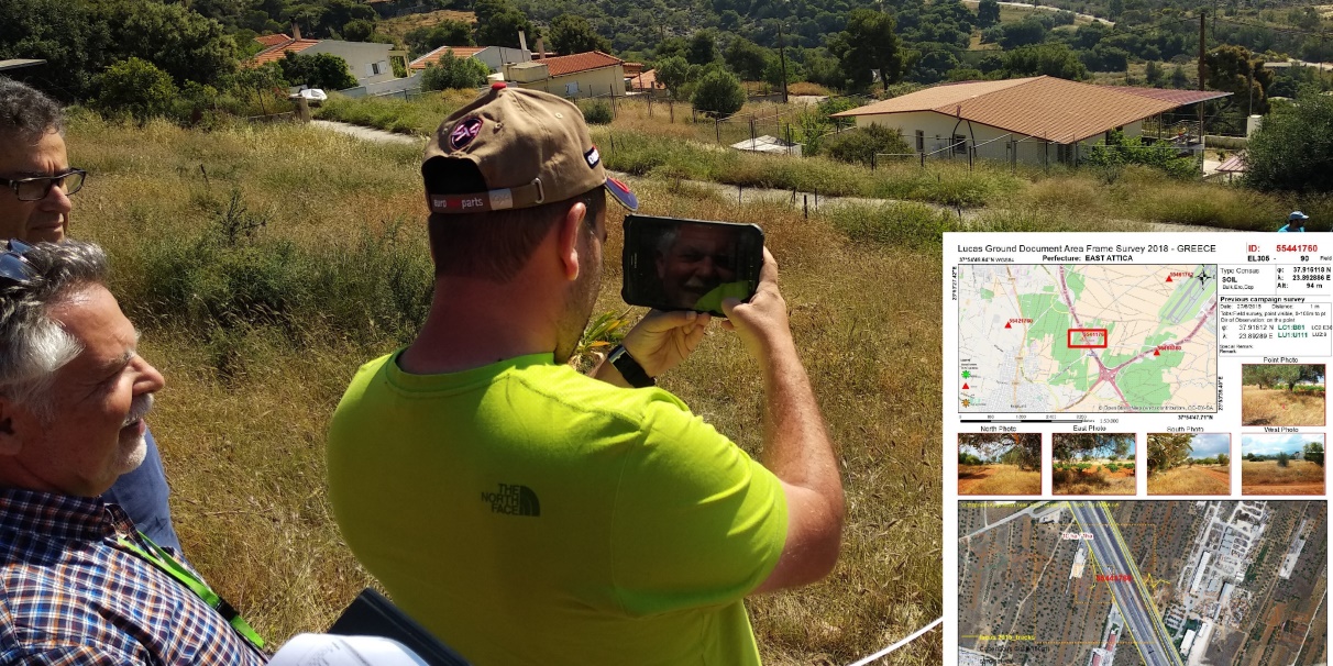
Since the EGNOS Open Service was declared available in 2009, Anaptixi employs handheld GNSS devices equipped with EGNOS, such as the Magellan eXplorist Xl, not only for the aforementioned cadastral activities, “but also for field inspection tasks related to area-based subsidies, such as those required by the Common Agricultural Policy (CAP), as well as any other reconnaissance surveys, such as the LUCAS Survey”, as Pantelis remarks. The LUCAS Survey, carried out by EUROSTAT on a three-yearly basis since 2006 and currently part of the Copernicus Land Monitoring System, focuses on the state and changes in the type and use of land. The survey is carried out in-situ, so a large number of observations are made and registered throughout the whole European Union.
Anaptixi has taken part in all LUCAS Surveys in Greece since 2009. For this purpose, Pantelis states that “the simultaneous work of more than 50 surveyors in different parts of Greece is usually required”. These LUCAS surveyors employ GNSS handheld devices to reach the specific point to be surveyed and to track the complete path that is followed for quality control purposes. In summary, every LUCAS Survey implies the availability of a high number of surveyors with GNSS units to acquire multiple positioning data with enough accuracy in different areas. In this context, EGNOS continuously provides GPS corrections over Europe, allowing LUCAS surveyors to enhance the accuracy of their GNSS handheld equipment in real time at no cost. As a result, Pantelis concludes that “EGNOS is for us the most cost-effective solution to perform the LUCAS Survey field tasks”.