The Hydrographic Office of the Polish Navy (HOPN) began its operations in 1920 and is currently in charge of the national maritime hydrographic services, including the maintenance of the national hydrographic database, production and updating of navigational charts and promulgation of navigational warnings.
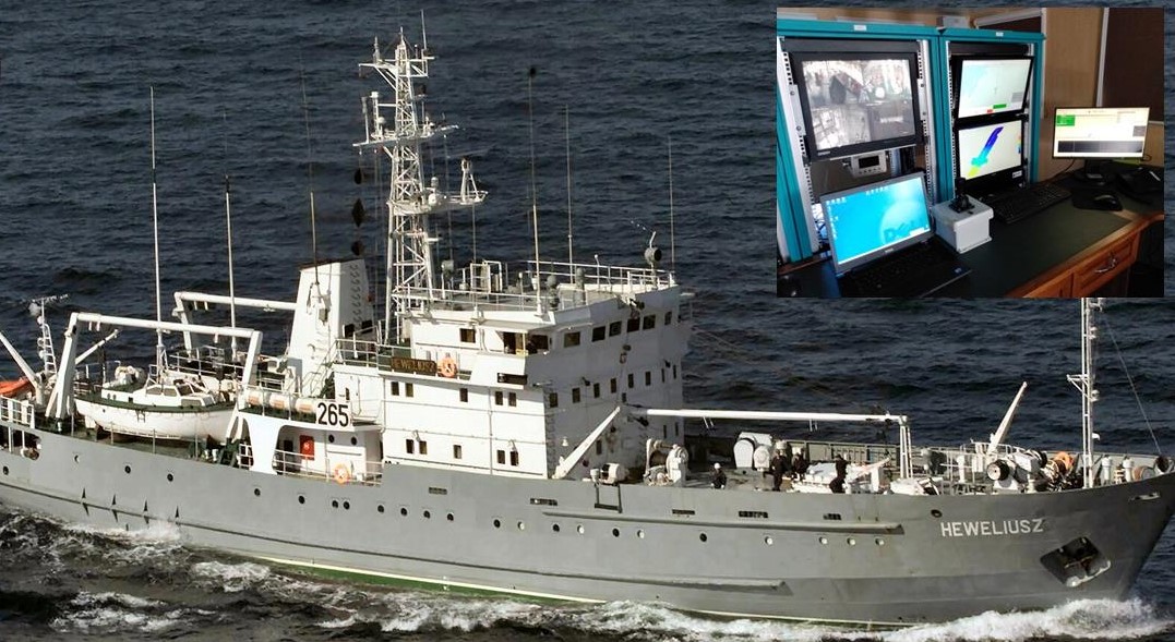
Surveys supervised by the HOPN are conducted along the maritime areas of the Republic of Poland by means of hydrographic ships, motorboats, Rigid Inflatable Boats (RIB) and autonomous surface vehicles in order to collect mainly bathymetric and environmental data.
This information is employed for the development of nautical charts, both in paper and electronic (ENC), as well as for the generation and update of other nautical publications. For this purpose, HOPN prepares an annual hydrographic schedule to survey Polish water continuously throughout the year, although final missions may be adapted to ship availability and weather conditions.
In hydrographic surveys, precise positioning data is crucial, so the collected information, such as water depth and seabed elements, is accurately represented in the nautical charts. For instance, the International Hydrographic Office (IHO) S-44 standard states that the position of any collected feature should be determined such that the horizontal uncertainty meets the specified requirements. This maximum allowed positioning error is classified into different orders, between 2 and more than 20 meters, depending on the water depth. For instance, Order 1a, which applies in areas shallower than 100 metres where under-keel clearance is less critical but features of concern to surface shipping may exist, requires a maximum error of 5 metres + 5% of depth. EGNOS is therefore a cost-effective option to comply with these IHO positioning requirements. In fact, Captain Dariusz Kolator, Chief of the HOPN, confirms that they “use EGNOS since 2011, after we found it available in the GNSS configuration of a new delivered multibeam echosounder”.
The HOPN hydrographic surveys are carried out in Polish sea waters, limited by the Exclusive Economic Zone (EEZ) border. In this way, the ship can be as far as 150 km from the coastline, where it can be difficult to get GNSS corrections by radio and/or Internet. As EGNOS signal is provided by satellites and its coverage area includes Polish waters, the ship’s GNSS receivers can make use of EGNOS corrections anywhere along the campaigns. In this sense, Captain Kolator comments that “during harbour and costal survey the use of RTK is mandatory. However, during offshore surveys, our on-board positioning system (Applanix POS MV) uses EGNOS to meet the order 1a horizontal requirements of the IHO S-44 standard”. In addition, the HOPN takes advantage of the information provided in the EGNOS User Support Website, as they consult it “mainly before a mission to check the risk of signal outage”, explains Captain Kolator.